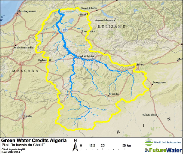
In Algeria, water resources are overexploited and nearing the limit of ecologic sustainable withdrawal of ground and surface water. Population growth puts an increasing pressure on land and water resources. Land use and management changes alter the overall water balance, leading to an increase in surface runoff, peak flows, soil erosion and sedimentation of downstream reservoirs, reducing water availability across the watershed.
To demonstrate the GWC concepts in Algeria, a GWC demonstration project has been set up under the Dutch programme “Internationaal Excelleren, 2g@there”, for the Oued de la Mina, which is a subcatchment of the Cheliff Basin in Northern Algeria. An important component of this demonstration project is to quantify the potentials of GWC interventions by using the so-called GWC Toolkit. This Toolkit is a combination of three components: (i) data resources, (ii) analytical assessment tools, and (iii) presenting and decision system. Based on computer simulation models the present situation is compared to situations where GWC would have been implemented. This quantification is undertaken by two modeling tools: SWAT and WEAP. SWAT (Soil Water Assessment Tool) is specifically developed to explore the impact of changes in soil and water management on runoff, groundwater recharge and erosion. The WEAP (Water Evaluation And Planning tool) links the upstream and downstream interactions and is particularly strong to evaluate and compare different scenarios.


