This harmonized, soil resources database was generated using all continental scale SOTER (SOTERLAC , 1:5M; SOTERSAF, 1:2M; SOVEUR, 1:2.5M) and SOTER-like databases (Northeastern Africa, 1:1M; North and Central Asia, 1:5M) produced up to 2005. The database was compiled as a joint activity of FAO and ISRIC-World Soil Information as a contribution to the Harmonised World Soil Database (HWSD).
The secondary data are presented in raster format (5 arc by 5 arc minutes) and may be used to update part of the information held on the outdated 1:5 M FAO-Unesco Soil Map of the World, pending global world coverage in SOTER.
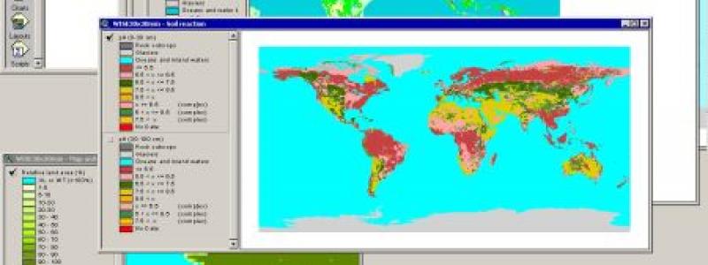
The interim data set (SOTWIS) contains parameter estimates for 18 soil parameters derived from measured soil profile data extracted from available full-scale SOTER databases and taxo-transfer rules derived from the ISRIC-WISE database.
Soil parameter estimates are presented for each component soil of a SOTER mapping unit for depth intervals of 0.2 m up to 1 m depth. They include; organic carbon, total nitrogen, pH (H2O), CECsoil , CECclay , base saturation, effective CEC, aluminium saturation, CaCO3 and CaSO4 content, exchangeable Sodium percentage, electrical conductivity of the saturation paste (ECe), bulk density, sand, silt and clay content, content of coarse fragments (>2 mm), and available water capacity (-33 to -1500 kPa; cm/m).
Coverage of SOTER-based soil property estimates:
At regional scale: Central Africa | Latin America and the Caribbean | Southern Africa
At national level: Countries: Jordan | Kenya | Tunisia