01 May 2023

Figure showing average uncertainty for an aggregation over different geographical areas indicating standard deviation (Mg ha1) of above-ground biomass in the Congo basin.


At global and continental scales, natural resource maps provide a basis for checking on how ecosystems are responding to human impact. However, how accurate are those maps, and how certain can we be that they are reliable to guide our actions on climate change, biodiversity preservation and other big issues?

25 Apr 2023

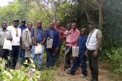
Field surveyors completing a Soils4Africa training in Zambia in March 2023.

Soils4Africa, a continent-wide effort in Africa to generate 20,000 new soil data points using standardized methods, is now in the fieldwork stage. Through coordinated soil sample collection, lab analysis and data infrastructures, the project aims to deliver the open-data soil information system (SIS) for Africa.

24 Apr 2023

IFDC President and CEO Henk van Duijn sits next to ISRIC Director Rik van den Bosch while signing the new partnership agreement

06 Apr 2023

The WORLDSOILS project consortium is building an Earth observation-based soil organic carbon monitoring system. WORLDSOILS successfully completed phase two in 2022 and is now working on the next phase.

Three key steps were achieved throughout 2022:

29 Mar 2023

The WRB working group in action during the Mongolia excursion in 2019

The World Reference Base (WRB) is an international soil classification system that evolved from the FAO-UNESCO Legend of the Soil Map of the World. It is now in its 4th edition, which was published in 2022.

06 Mar 2023

Wageningen University and Research Executive Board President Dr Sjoukje Heimovaara met with ISRIC – World Soil Information director and staff on 27th February, 2023 at the World Soil Museum. In a highly interactive session, Dr Heimovaara was introduced to the programmes and projects of ISRIC.

28 Feb 2023
Figure 5 from the article with total nitrogen simulations plotted against soil organic carbon simulations showing that multivariate random forest best reproduces the skewness of the soil properties and their positive correlation.

A new open access paper from ISRIC-supported PhD researcher Stephan van der Westhuizen and co-authors demonstrates the use of multivariate random forest modelling in digital soil mapping.

20 Feb 2023
Land Soil Crop - Information Services (LSC Hubs) workshop participants in Debre Birhan, Ethiopia. Photo credit: Brook Makonnen, ILRI
15 Feb 2023

Photo credit: Le Studium

At the 2nd Joint workshop of the International Union of Soil Scientists (IUSS) working groups for “Digital Soil Mapping” and “Global Soil Map” from February 7-9, 2023, six ISRIC – World Soil Information staff made presentations. The theme for the workshop was “Soil Mapping for a Sustainable Future” and it took place in Orleans, France hosted at Le Studium Loire Valley Institute for Advanced Studies.

01 Feb 2023

The Organising Committee of the 2023 Wageningen Soil Conference invites soil scientists from around the world to submit abstracts of their work for oral as well as poster sessions. Abstracts are due by April 17, 2023 and should fit within one of the following topics of the conference: