Thanks to our data providers!
")
ISRIC WDC-Soils, regular member of the ICSU-World Data System, aims to serve the user with a selection of standardised soil data through WoSIS (World Soil Information Service). The development of this service has been made possible thanks to the contributions and shared knowledge of a steadily growing number of data providers and experts. We gratefully acknowledge their contributions!
Processing the wealth of data shared with us is an enormous and time consuming task that involves four main steps: a) safeguarding the original data sets in the ISRIC repository, b) importing the data into the WoSIS data model, c) standardising the original data to the WoSIS standard, and d) serving the quality-assessed data to the user community. Stage b) to d) are visualised below using coloured dots.
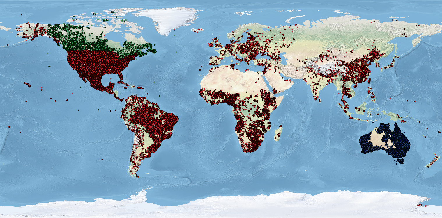
The red dots represent the complement of soil profiles for which standardised data are served by WFS (98,776 profiles). The green dots refer to data in the standardisation stage (Canadian Soil Information Service; Canadian Upland Forest Soil Carbon Database; Forest Ecosystem Carbon Database, and Canada Soil Profile Database, in total 12,170 profiles). The blue dots refer to data that are being imported into the WoSIS data model (Soil and Landscape Grid of Australia DSM project; 274,495 profiles). Not shown is the selection of soil profile data held in our repository, with adequate licences (i.e. less restrictive than CC-BY, CC-BY-NC), that we could not yet process/standardise due to time constraints.
Cooperating institutions and experts that shared their data are listed here.
As shown above, there are still geographical gaps in WoSIS. Should you wish to contribute point data to the global WoSIS effort, please contact us and we will be happy to assist.