WISE Soil Property Databases
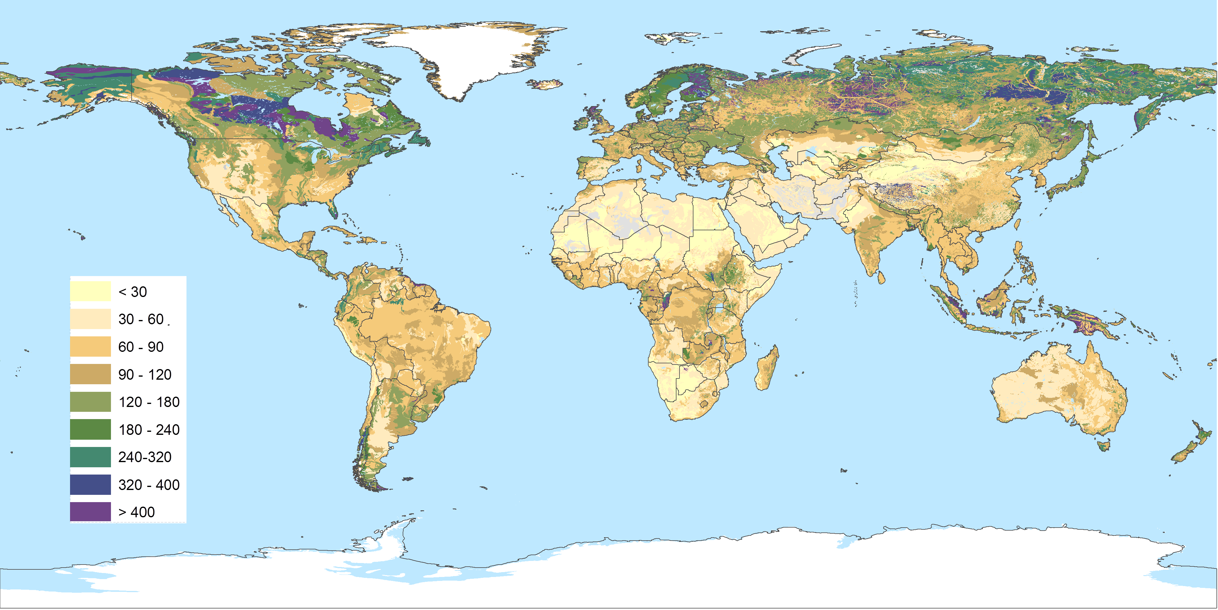
Harmonised sets of soil property estimates are necessary for a wide range of environmental studies at a global scale: agro-ecological zoning, assessments of crop production, soil vulnerability to pollution, soil carbon stocks and change, and soil gaseous emission potentials. The WISE project [1991-2016] has developed a range of harmonised world soil databases (point and grid-based) that may be used to underpin such broad scale studies, pending the availability of regionally and globally more detailed datasets.
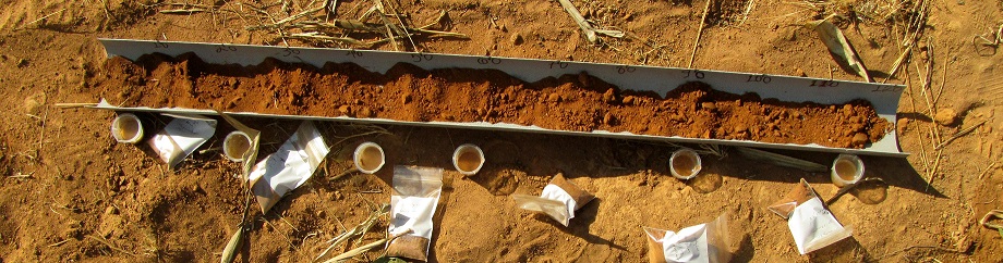
Soil auger profile sampling and analysis, Maguvani, Tanzania (Credit: Prof. Ray Weil, University of Maryland)
There are two types of WISE databases. The first comprises a set of harmonised soil profile data considered to be representative for the soil units of the FAO Soil Map of the World, and later the Harmonised World Soil Database (HWSD). These profiles were used to develop consistent taxo-transfer rules to estimate soil property estimates, by FAO soil unit and depth zone, including: organic carbon, total nitrogen, pHwater, cation exchange capacity, base saturation, aluminium saturation, calcium-carbonate and gypsum content, exchangeable sodium, electric conductivity, bulk density and the sand, silt and clay fractions. In the second type of WISE databases, the above soil property estimates were linked to the spatial data of the 1:M FAO Soil Map of the World respectively used to fill gaps in SOTER databases (so-called SOTWIS databases), using the FAO soil classification as main ‘carrier-of-soil information’.
WISE-derived databases can be used to address a range of global issues, assessments of crop production, soil vulnerability to pollution, soil carbon stocks and change, and soil gaseous emission potentials.
WISE products harmonise results of soil inventories collected at different times and at different scales, with different survey methods and analytical procedures. Hence, the data are considered appropriate for regional and global modelling. For (sub)national level assessments, however, one should create or use national level soil databases.
Numerous organizations and scientists have contributed in various ways to WISE-related activities; we gratefully acknowledge their contributions.
Point and raster datasets
A selection of WISE-derived data sets (point and raster) is available through our soil data hub.
We recommend using the latest dataset as shown in the table below; please note that no further updates of WISE itself are foreseen. Results of the last study (WISE30sec) were used to provide soil parameters estimates for version 2 of the Harmonised World Soil Database (FAO and IIASA 2023).
Note: Point data collated for WISE have been incorporated the ISRIC World Soil Information Service (WoSIS). WoSIS itself is used to underpin SoilGrids-related soil mapping activities at ISRIC.
|
Soil geographical |
WISE version & |
Main elements of taxotransfer procedure |
|---|---|---|
|
HWSD, 30”x30”*
|
WISE30sec, v1.0 |
|
|
DSMW, 5’x5’
|
WISE5min, v1.2 |
|
|
|
WISE5min, v1.0 |
|
|
DSMW, 0.5°x0.5°
|
WISE30min, v3.0 |
|
|
|
WISE30min, v2.0 |
|
|
WISE30min, v1.0 |
|
|
|
IGBP-DIS gridded soil surfaces |
|
Note (15/06/2020): The units for CaCO3 content (or TCEQ) are g(CaCO3)/kg. (See typo in Report 2012-10, p. 41 under TCEQ).